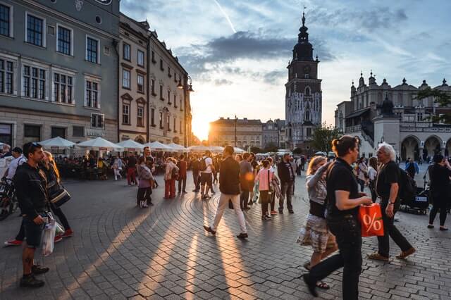
What shape is Kraków’s Main Square? A square that isn’t perfect
Kraków’s Main Square is roughly a square about 200 metres on each side, with an area of around 4 hectares — one of the largest medieval market squares in Europe. But it isn’t a perfect square: its regular plan was distorted by churches that are older than the square itself. How was it created, why isn’t it even, and how has it changed over the centuries?
What shape is Kraków’s Main Square?
The square was laid out when Kraków received its charter under Magdeburg law on 5 June 1257, under Duke Bolesław the Chaste. It was planned as a square of about 200 × 200 metres surrounded by a regular grid of streets — in the Middle Ages 11 streets led into it, three from each side except the side with Grodzka Street.
The plan isn’t perfect, though. The surveyors had to fit in buildings older than the charter — above all St Mary’s Basilica and the Church of St Adalbert, which still stands on the square at an odd angle to the surrounding frontages. So the Main Square is really an irregular quadrilateral close to a square rather than a textbook figure. Today the frontages are known as lines A–B, C–D, E–F and G–H.
A square that grows
The square looks flat and unchanging, but over the centuries its level rose — in places by more than 5 metres since the 13th century. That’s why the Church of St Adalbert now sits below the level of the square, and old cobbled surfaces lie hidden beneath it — you can see them in the Rynek Underground museum.
How the Main Square has changed
Today only the Cloth Hall, the Town Hall Tower and the Church of St Adalbert stand on the square. In the Middle Ages, though, it was densely built up: there was a town hall, the Great and Small Weigh Houses, the Rich Stalls, a cloth-shearing house, wooden stalls and butchers’ stands. The square was above all a place of trade.
Most of these buildings disappeared in the 19th century, when the authorities tidied up the city. The town hall was demolished in 1817–1820 — only the tower survived.
Kościuszko’s wandering plaque
On the Main Square, on 24 March 1794, Tadeusz Kościuszko took the oath that launched the uprising named after him. The commemorative plaque in the paving has moved several times: the first was laid in 1879, a granite slab replaced it in 1883 and was moved when tram tracks were built, the Germans removed it during the occupation, a new one was laid in 1946, and the current black marble plaque dates from the 1960s.
Where to stay in Kraków
The closest base for the Main Square is Best Western Plus Kraków Old Town at Świętej Gertrudy 6 — about 500 m from the square, right by the Planty park. A characterful alternative is Hotel Regent in a historic townhouse in Kazimierz, about 15 minutes’ walk away.
Frequently asked questions
Is Kraków’s Main Square a perfect square?
Roughly — it was laid out as a square about 200 m on each side. But it isn’t a perfect square: the plan was distorted by older churches, including St Mary’s and St Adalbert’s.
How big is Kraków’s Main Square?
About 4 hectares (200 × 200 m). It’s one of the largest medieval market squares in Europe.
When was the Main Square created?
When the city was chartered under Magdeburg law on 5 June 1257, under Duke Bolesław the Chaste.
Updated in October 2026.